Tabula geographico-hydrographica motus oceani currentes, abyssos, montes igniuomos in universo orbe indicans
Tabula geographico-hydrographica motus oceani currentes, abyssos, montes igniuomos in universo orbe indicans | Stampe | KIRCHER ATHANASIUS

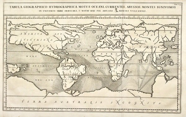
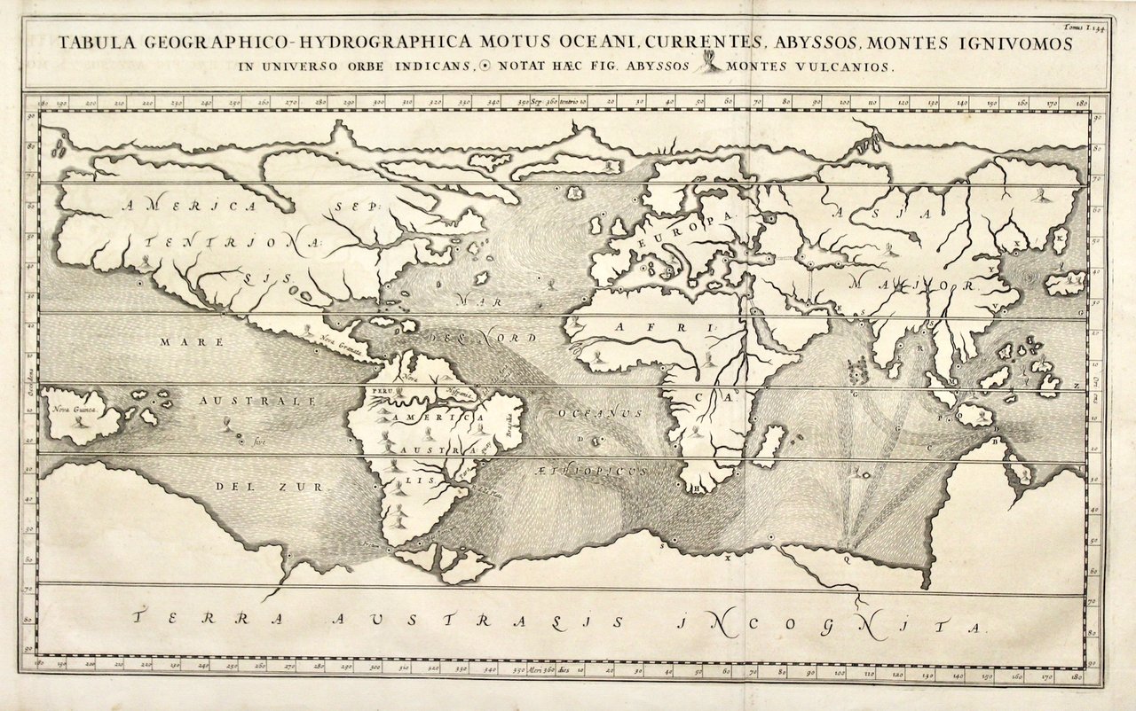
Tabula geographico-hydrographica motus oceani currentes, abyssos, montes igniuomos in universo orbe indicans
Tabula geographico-hydrographica motus oceani currentes, abyssos, montes igniuomos in universo orbe indicans | Stampe | KIRCHER ATHANASIUS
Metodi di Pagamento
- PayPal
- Carta di Credito
- Bonifico Bancario
- Pubblica amministrazione
- Carta del Docente
Dettagli
- Anno di pubblicazione
- 1665
- Luogo di stampa
- Amsterdam
- Incisori
- KIRCHER ATHANASIUS
- Soggetto
- mondo, oceani, correnti
Descrizione
Incisione in rame, mm 340x554. Tratta da “Mundus subterraneus” una fra le più note opere del grande gesuita, autore di moltissime opere, relative ad ogni campo dello scibile umano. In questa opera Kircher analizza la struttura interna della terra: egli considera che vi è un centro in continua evoluzione collegato alla crosta in numerosi punti; all’interno della terra vi sono enormi riserve d’acqua, che quando entra in contatto col fuoco scatena terremoti, uragani e distruzioni. Ottimo esemplare con traccia delle pieghe originali della tavola. Copper engraving, mm 340x554. From "Mundus Subterraneus" by Kircher. He was a celebrated Jesuit scholar and one of the first compilers of semi-scientific knowledge about the physical features of the earth. As with most of his maps, this chart shows the ocean currents, chasms and volcanoes as then recorded. Kircher suggested the earth had a central connected to the crust at many points and also contained big reservoirs of water; when water and fire interacted, volcanoes, storms and earthquakes were the result. TOOLEY: Dictionary p.357A very good example with original binding folds, side margins somewhat short
