Isthme de Soueys-Plan du Port de Soueys et du fond du Golf Arabique
Isthme de Soueys-Plan du Port de Soueys et du fond du Golf Arabique | Stampe | COLLIN E.

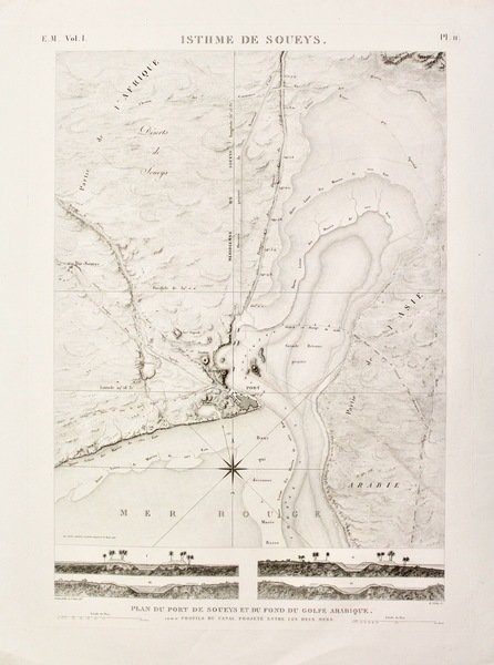
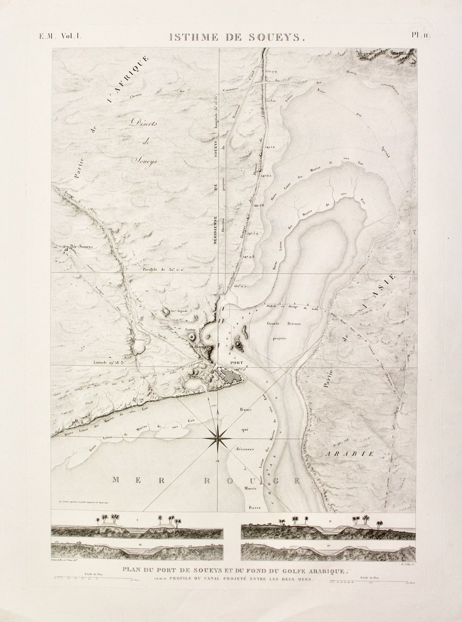
Isthme de Soueys-Plan du Port de Soueys et du fond du Golf Arabique
Isthme de Soueys-Plan du Port de Soueys et du fond du Golf Arabique | Stampe | COLLIN E.
Metodi di Pagamento
- PayPal
- Carta di Credito
- Bonifico Bancario
- Pubblica amministrazione
- Carta del Docente
Dettagli
- Anno di pubblicazione
- 1820
- Luogo di stampa
- Parigi
- Incisori
- COLLIN E.
- Soggetto
- Suez
Descrizione
Copper engraving, mm 610x450 (platemark), signed "Gratien lePere et St. Denis del.t" and "E. Collin sc.t". Very good condition. A beautiful engraved map of the Port of Suez and environs, with small profiles of "the planned canal between the two seas." This very large, finely engraved image is plate 11 from Volume I of the Modern State section of the monumental publication "Description de L'Egypte," which documented the research of the "savants" who accompanied Napoleon Bonaparte's ambitious expedition to Egypt (1798-1801). The European demand for information about Egypt and its glorious monuments led to the publication of two editions of the work, with engravings pulled from the same printing plates; this is from the second edition, uncolored as issued.
