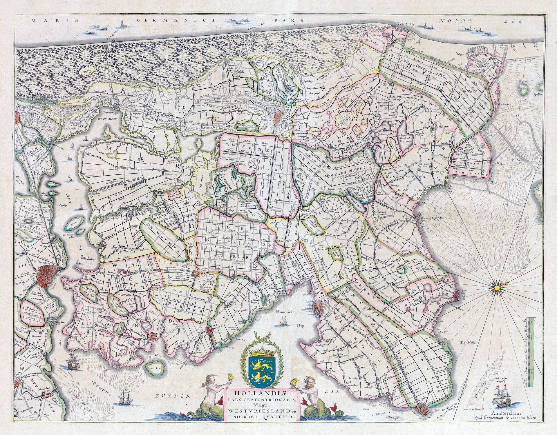
Hollandiae pars septentrionalis vulgo Westuriesland en 't noorder quartier
Hollandiae pars septentrionalis vulgo Westuriesland en 't noorder quartier | Stampe | BLAEU WILLEM
Hollandiae pars septentrionalis vulgo Westuriesland en 't noorder quartier
Hollandiae pars septentrionalis vulgo Westuriesland en 't noorder quartier | Stampe | BLAEU WILLEM
Metodi di Pagamento
- PayPal
- Carta di Credito
- Bonifico Bancario
- Pubblica amministrazione
- Carta del Docente
Dettagli
- Anno di pubblicazione
- 1650
- Luogo di stampa
- Amsterdam
- Incisori
- BLAEU WILLEM
Descrizione
Incisione in rame, mm 420x525, colorituta a mano coeva, testo latino al verso. Elegante e piacevole carta, tratta da Atlas Novus, arricchita da un bel cartiglio con stemmi. <BR>Ottimo esemplare perfettamente conservato. W. Blaeu, astronomo allievo di Tycho Brahe, fondò un'officina per la costruzione di globi nel 1599; quasi immediatamente iniziò a pubblicare anche carte geografiche, giungendo nel 1630 alla creazione del primo atlante "Atlantis Appendix" e cinque anni dopo, della prima edizione in due tomi del "Atlas Novus". Dopo la sua morte nel 1638, a cura del figlio Johan si giunse nel 1662 alla pubblicazione del celebre "Atlas Maior" in 11 volumi. Nel 1672 un incendio distrusse l'officina e segnò la fine dell'attività. <BR>Copper engraving, 420 x 525 mm, contemporary colour, latin text on verso. Elegant and attractive map, taken from Atlas Novus, enriched with a beautiful cartouche with coats of arms. An excellent, perfectly preserved example. W. Blaeu, an astronomer and student of Tycho Brahe, founded a globe-making workshop in 1599; almost immediately, he began publishing maps, producing the first atlas, the "Atlantis Appendix," in 1630, and the first two-volume edition of the "Atlas Novus," five years later. After his death in 1638, his son Johan edited the celebrated "Atlas Maior," in 11 volumes, in 1662. A fire destroyed the workshop in 1672, marking the end of the business. Copper engraving, 420 x 525 mm, Latin text on verso.<BR>
