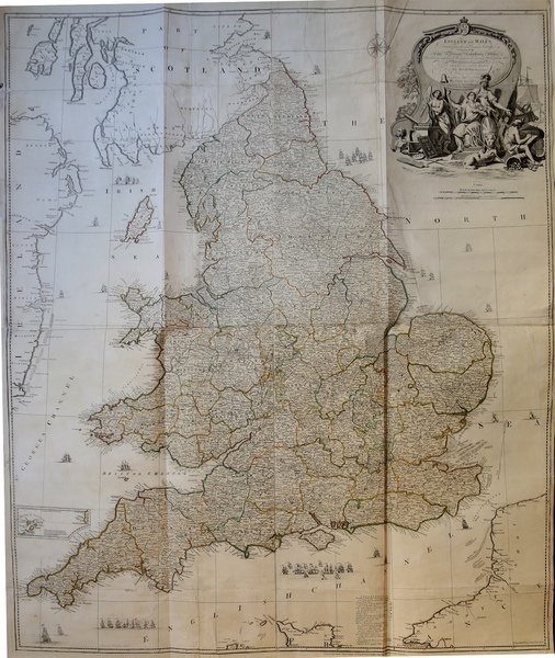
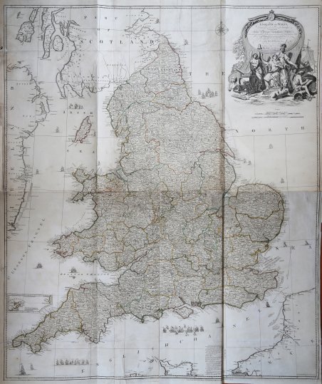
England and Wales, drawn from the most accurate surveys containing all the cities, boroughs, market towns & villages
England and Wales, drawn from the most accurate surveys containing all the cities, boroughs, market towns & villages | Stampe | KITCHIN Thomas

England and Wales, drawn from the most accurate surveys containing all the cities, boroughs, market towns & villages
England and Wales, drawn from the most accurate surveys containing all the cities, boroughs, market towns & villages | Stampe | KITCHIN Thomas
Metodi di Pagamento
- PayPal
- Carta di Credito
- Bonifico Bancario
- Pubblica amministrazione
- Carta del Docente
Dettagli
- Anno di pubblicazione
- 1790
- Luogo di stampa
- Londra
- Formato
- 1100 X 800
- Incisori
- KITCHIN Thomas
Descrizione
Dettagliata mappa murale di Inghilterra e Galles, con l'indicazione precisa di strade, città, distanze, centri urbani ecc, incisa da John Rocque - prolifico cartografo inglese del XVIII sec.Questa mappa è pubblicata nell'atlante curato da Thomas Kitchin A General Atlas Describing the Whole Universe, pubblicato a Lodra da Robert Sayer nel 1790.Incisione su rame, impressa su quattro fogli grandi uniti insieme, coloritura coeva dei confini. In ottimo stato di conservazione. A very detailed map of England and Wales showing roads by type, cities, distances, market towns, latitude and longitude of important places, villages with and without stages, distances from London, and more. John Rocque was a prolific map maker in London during the 18th century. This map as well as his two sheet map of Ireland appeared in Thomas Kitchin's A General Atlas Describing the Whole Universe of 1790.Shows forested areas, classified roads with distances, etc. Relief shown pictorially. Includes inset map of the Isles of Scilly and drawings of ships.Engraved map printed on 4 sheets comprising. Counties in outline color. In very good contion. Cfr.
