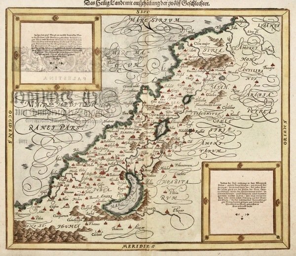
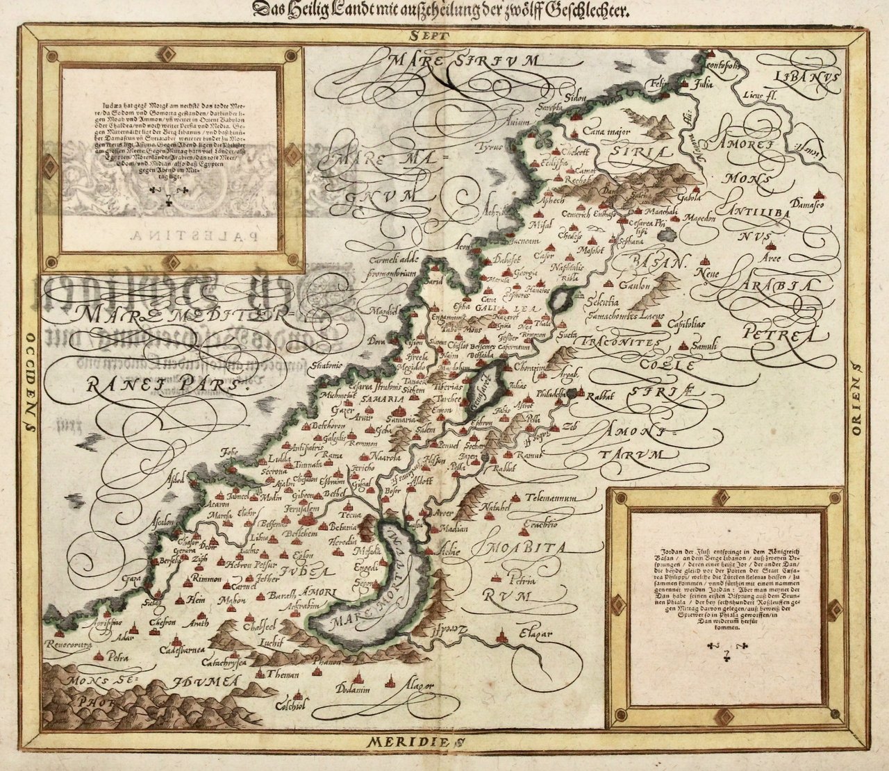
Das Heilig Landt mit Ausscheilung der zwölff Geschlechter.
Das Heilig Landt mit Ausscheilung der zwölff Geschlechter. | Stampe | MUENSTER SEBASTIAN

Das Heilig Landt mit Ausscheilung der zwölff Geschlechter.
Das Heilig Landt mit Ausscheilung der zwölff Geschlechter. | Stampe | MUENSTER SEBASTIAN
Metodi di Pagamento
- PayPal
- Carta di Credito
- Bonifico Bancario
- Pubblica amministrazione
- Carta del Docente
Dettagli
- Anno di pubblicazione
- 1588
- Luogo di stampa
- Basilea
- Incisori
- MUENSTER SEBASTIAN
- Soggetto
- Terra Santa
Descrizione
Silografia colorata a mano, mm 310x365 su foglio di mm 353x465. Tratta da "Cosmographey", la prima descrizione tedesca del mondo intero e la più importante opera geografica tedesca dopo la Cronaca di Norimberga del 1493. Buon esemplare, con due piccoli strappetti restaurati all'estremità della piega centrale ed un terzo nel margine inferiore. Laor, Maps of the Holy Land 532.<BR>Woodcut, hand colour, mm 310x365 on sheet mm 353x465. From "Cosmographey", one of the most famous geographical-historical works after the "Liber Chonicarum" by Schedel of 1493. Good condition, two little restored tears at centrefold and a third in bottom margin<BR>The map shows Holy Land as divided among the 12 Tribes even if they are not shown on the map itself. Two inset explanatory texts. After Tilemannus Stella.<BR>Printed by Henric Petri in 1588, in which year new woodcuts were prepared for the Cosmographia. Laor, Maps of the Holy Land 532.<BR><BR>
