Anchorages in New Hebrides Islands
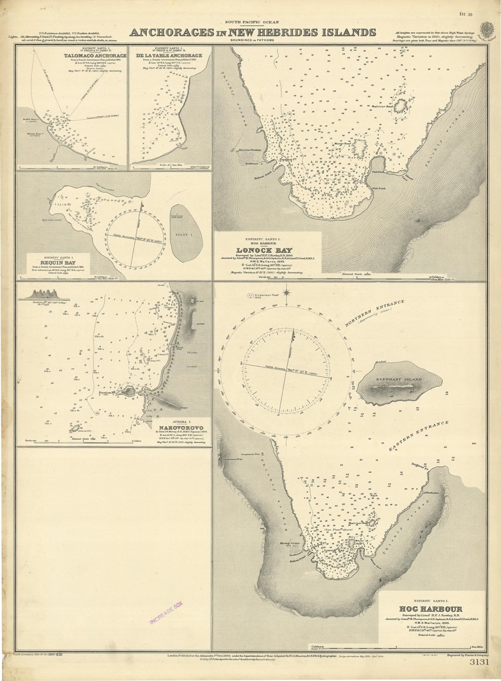
Anchorages in New Hebrides Islands
Metodi di Pagamento
- PayPal
- Carta di Credito
- Bonifico Bancario
- Pubblica amministrazione
- Carta del Docente
Dettagli
- Formato
- mm 623x482
- Edizione
- '900
- Incisori
- Admiralty Charts
- Soggetto
- Espiritu Santo Island - New Hebrides
- Disegnatori
- Admiralty Charts
- Lingue
- Italiano
Descrizione
Ancient and original map of Anchorages in New Hebrides Islands. In the left side of the chart insert of Talomaco Anchorage From a French Government Plan published 1892, De La Table Anchorage From a French Government Plan published 1892, Requin Bay From a French Government Plan published 1884, Narovorovo By Lieut. J.B. Murray, H.M.S. "Pegasus", 1906.In the right side of the chart insert of Lonock Bay Surveyed by Lieut. H.F.J. Rowley, 1899. Assisted By Lieut. H. Thompson & G.D. Jephson & Lieut. J. Deed H.M.S. "Wallaroo" 1899, Hog Harbour Surveyed by Lieut. H.F.J. Rowley, Assisted By Lieut. H. Thompson & G.D. Jephson & Lieut. J. Deed H.M.S. "Wallaroo" 1899, London Published at the Admiralty, 2nd June 1900, under the Superintendence of Rear Admiral Sir W.J.L. Wharton, Hydrographer. Hog Harbour is place where today is possible to admire Lonnoc Beach and not far away Champagne Beach.Small corrections: 1925. Autore: Admiralty Charts. Luogo: Espiritu Santo Island - New Hebrides. Anno: '900. Tecnica: incisione. Dimensioni: 623x482 mm
Anno di pubblicazione: '900