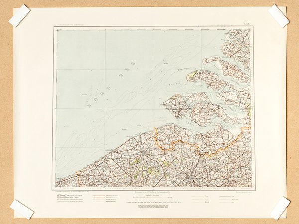
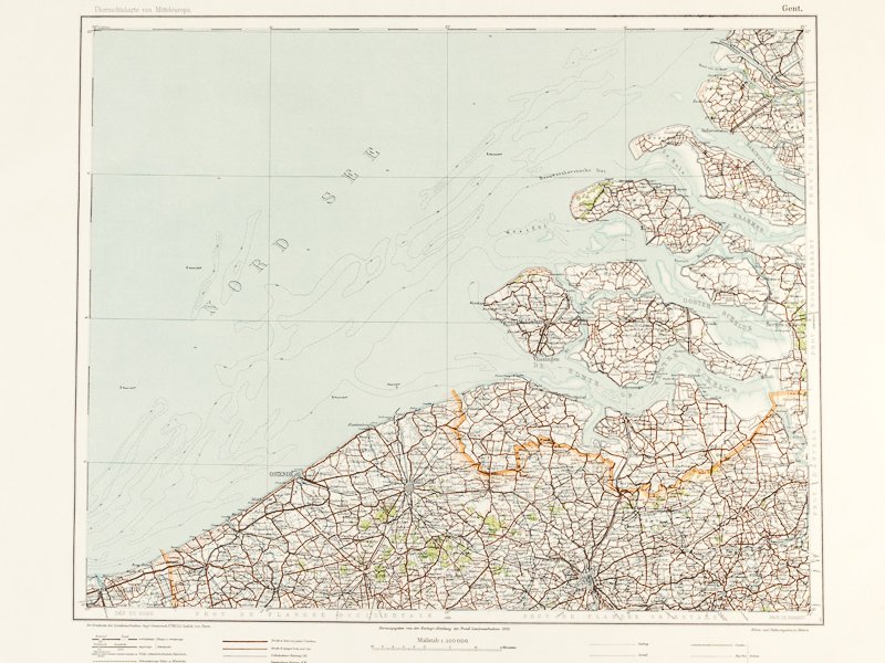
Gent. Ubersichskarte von Mitteleuropa 1 : 300.000 [ German military map - Nederlands and Belgium : Gand - Gent Nord See ]
Gent. Ubersichskarte von Mitteleuropa 1 : 300.000 [ German military map - Nederlands and Belgium : Gand - Gent Nord See ] | Libri antichi e moderni | Collectif
Libri antichi e moderni
Collectif
1940
150,00 €
(GRADIGNAN,
Francia)
Metodi di Pagamento
- PayPal
- Carta di Credito
- Bonifico Bancario
- Pubblica amministrazione
- Carta del Docente
Dettagli
- Anno di pubblicazione
- 1940
- Autore
- Collectif
- Soggetto
- Seconde Militaria Géographie Belgique
- Lingue
- Tedesco
Descrizione
Map size 65 x 50 cm, 1/300.000, Herausgegeben von der Kartog. Abteilung der Preuss. Landesaufnahme 1909, s.d., no date, probably 1940 / 1941 Fine original map, used by the german military forces (Wehrmacht or Luftwaffe) during World War II. Très bel état pour cette belle carte, à l'usage des troupes militaires allemandes lors de la Seconde Guerre Mondiale. Les couleurs sont parfaitement conservées.
