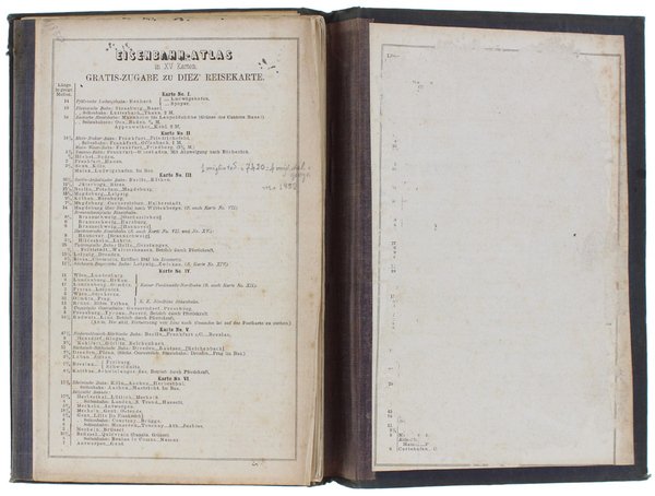
EISENBAHN-ATLAS IN XV KARTEN. GRATIS-ZUGABE ZU DIEZ REISERKARTE [Original ediition: not a reprint]
EISENBAHN-ATLAS IN XV KARTEN. GRATIS-ZUGABE ZU DIEZ REISERKARTE [Original ediition: not a reprint] | Libri antichi e moderni |
Libri antichi e moderni
Gotha Justus Perthes, no date,,
1844


EISENBAHN-ATLAS IN XV KARTEN. GRATIS-ZUGABE ZU DIEZ REISERKARTE [Original ediition: not a reprint]
EISENBAHN-ATLAS IN XV KARTEN. GRATIS-ZUGABE ZU DIEZ REISERKARTE [Original ediition: not a reprint] | Libri antichi e moderni |
Libri antichi e moderni
Gotha Justus Perthes, no date,,
1844
262,00 €
(Rivalba,
Italia)
Metodi di Pagamento
- PayPal
- Carta di Credito
- Bonifico Bancario
- Pubblica amministrazione
- Carta del Docente
Dettagli
- Anno di pubblicazione
- 1844
- Editori
- Gotha Justus Perthes, no date,
- Soggetto
- FERROVIE TRENI, CARTE GEOGRAFICHE, TOPOGRAFIA GEODETICA CARTOGRAFIA CARTE GEOGRAFICHE
Descrizione
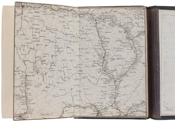
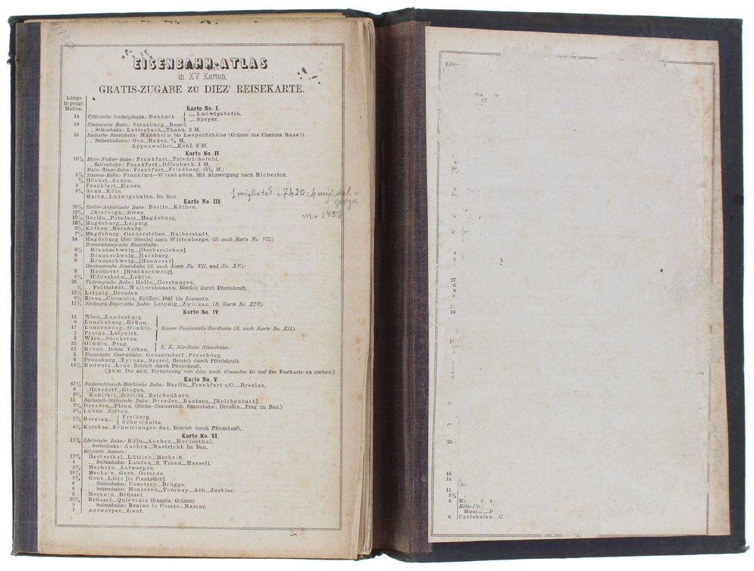
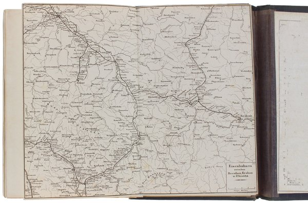
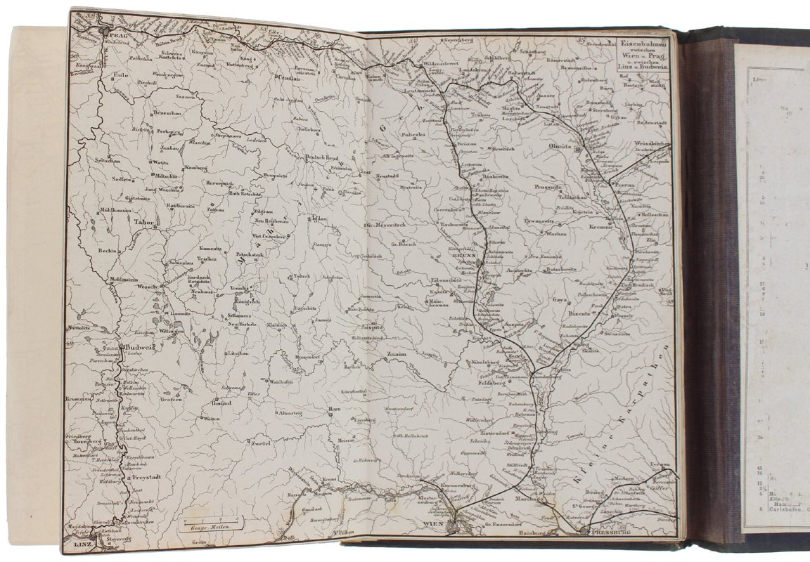
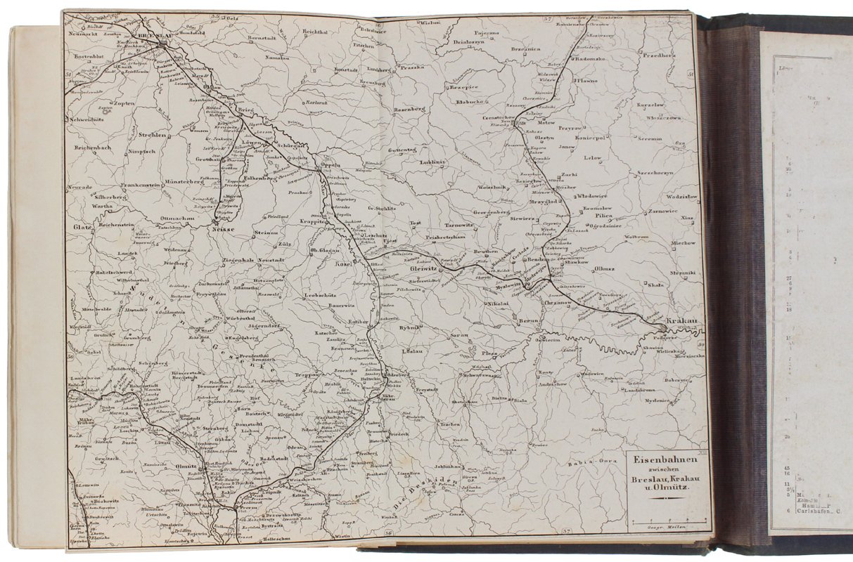
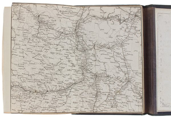
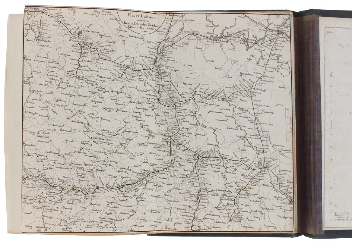
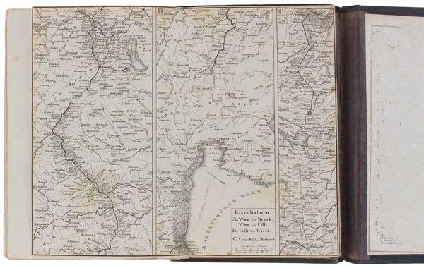
(Codice OS/0275) Atlas in 8° (22,5x15,5 cm): 12 double-plates, 15 litho maps mounted in a folder: Germany railway lines encompassing parts of Czeckoslovakia, Poland, Switzerland, Austria, the Netherlands, Belgium, France and Italy. Original black cloth covers, gilted title, blind stamped frame. The table of content (2 pp., some marks of use) is present; totally scraped out the final page tipped in to the inside of the back cover. A very good exemplar. ~~~ SPEDIZIONE IN ITALIA SEMPRE TRACCIATA
