Recueil de 163 principaux plans des ports et rades de la Mediterranée.
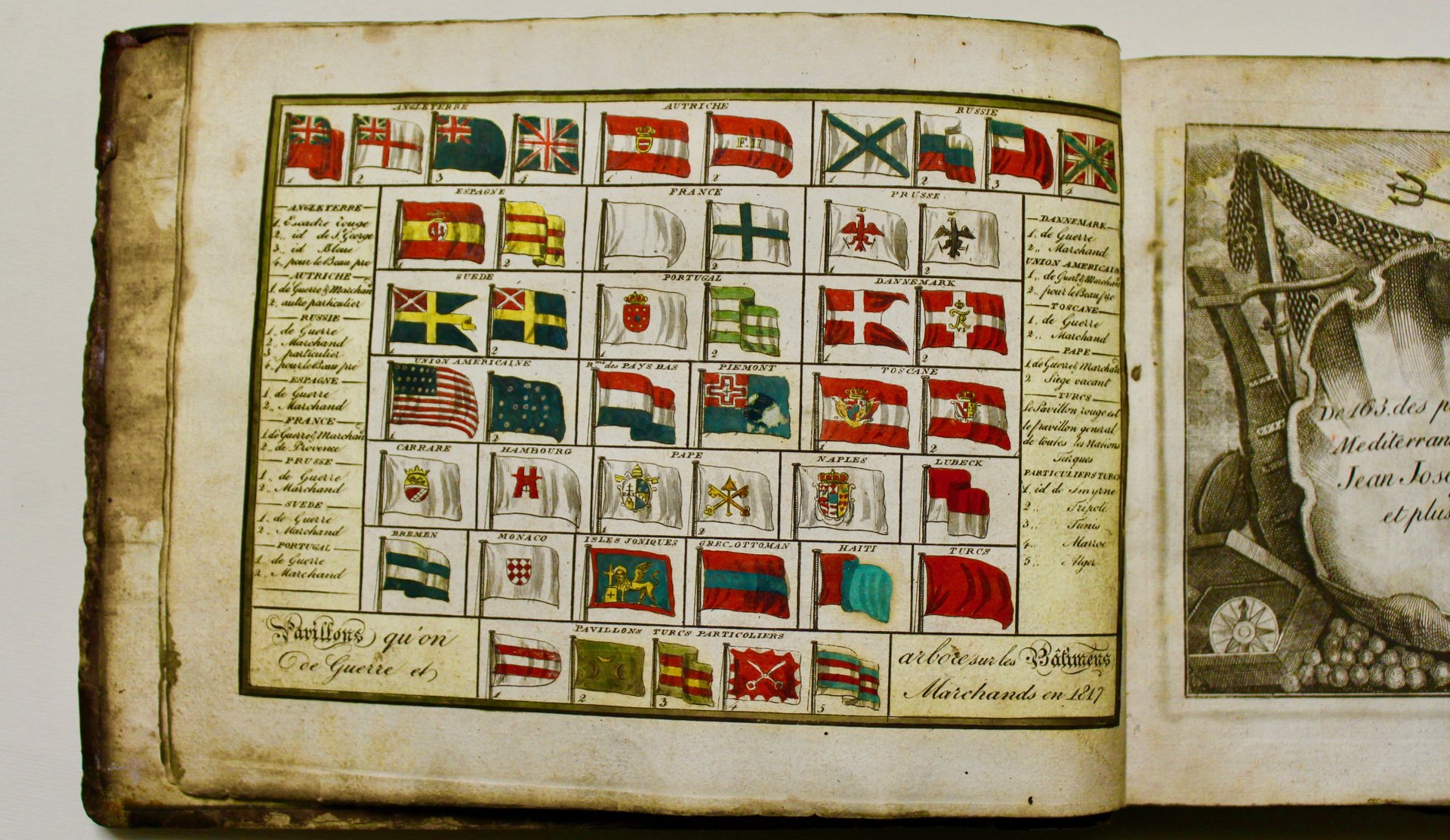
Recueil de 163 principaux plans des ports et rades de la Mediterranée.
Metodi di Pagamento
- PayPal
- Carta di Credito
- Bonifico Bancario
- Pubblica amministrazione
- Carta del Docente
Dettagli
- Anno di pubblicazione
- 1817
- Luogo di stampa
- Livorno
- Autore
- Allezard Jean Joseph - Roux, Joseph
- Editori
- chez Jacques (Giacomo) Aliprandi
Descrizione
Oblong 4to (173 x 225 mm), contemporary vellum with spine and corners in brown calf, coloured edges (some light marginal foxing here and there, light occasional stains). Coloured engraving of flags (civil and war ensigns) as frontispiece, engraved title page and 163 engraved maps (some lightly coloured). With 2 letterpress pages of index at the end, and the addition of a plan of the port of Savona, and a folding engraved plan of the harbor of Odessa (both not belonging to this work). One map comes from a different copy. A nice copy of this portable atlas of the principal harbours and bays of the Mediterranean, including the plans of numerous ports on the Barbary Coast (Tanger, Oran, Algiers, Tunis, Monastir, Sfax, Tripoli, Bengasi, Essaouira), the Greek islands, and the Eastern coast of the Mediterranean (Beirut, Tyre). Phillips 196, 3974 & 5172; Zacharakis 1967-2040 (other editions). <BR>