LE PROVINCIE CHE SONO AL SUD EST DELL'INGHILTERRA
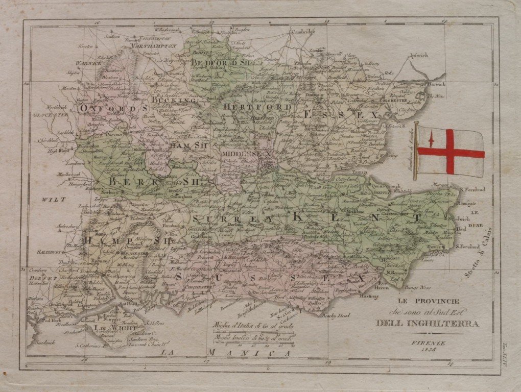

LE PROVINCIE CHE SONO AL SUD EST DELL'INGHILTERRA
Metodi di Pagamento
- PayPal
- Carta di Credito
- Bonifico Bancario
- Pubblica amministrazione
- Carta del Docente
Dettagli
- Anno di pubblicazione
- 1838
- Luogo di stampa
- FIRENZE
Descrizione
Bella mappa acquarellata del 1838 tratta probailmente da un atlante che rappresenta le provincie del sud est dell'Inghilterra (Bedfordshire, Oxfordshire, Hertfordshire, Essex, Hamshire, Middlesex, Berkshire, Surrey, Kent, Hampshire, Sussex). In buone condizioni. DIMENSIONI FOGLIO: cm 45x29,5 DIMENSIONI INCISIONE: cm 33x25 EPOCA: 1838 CONDIZIONI: Buone, fioriture e margini usurati, lieve gora al margine destro. Very beautiful coloured map of 1838 probably from an atlas with aquarello representing the provinces of south east England(Bedfordshire, Oxfordshire, Hertfordshire, Essex, Hamshire, Middlesex, Berkshire, Surrey, Kent, Hampshire, Sussex). LEAF DIMENSION: cm 45x29,5 ENGRAVING DIMENSION: cm 33x25 DATE: 1838 CONDITIONS: Good. Foxings and worn edges; slight humidity stain in the right edge.